
Standing
On Half a
Billion
Years
What if we told you that somewhere in southern Thailand, you can hold a 470-million-year-old fossil in your bare hands — an actual creature from a time when complex life was still figuring out the whole "having a body" situation — while a kingfisher hunts three metres away, completely unbothered by the weight of geological time?
Welcome to Satun UNESCO Global Geopark — Thailand's first and, as of 2026, still only geopark. Designated April 2018. 2,597 square kilometres of coastline and over 50 islands where Earth decided to keep a diary for 500 million years, wrote it in limestone and fossils, and then waited patiently for someone to actually stop and read it.
Most tourists don't stop. They're too busy speed-boating to Koh Lipe, which is, without them knowing, sitting on some of the most geologically significant real estate in Southeast Asia. The geopark was there the whole time. Nobody handed them the manual.
Their loss is spectacularly, beautifully yours.
Quality
Before you pack your bags, read this. We score every hidden gem on the metrics that actually matter — tourist density, cultural depth, how badly it'll ruin you for ordinary travel — so you know exactly what you're walking into. And whether you should.
Thailand's only UNESCO Global Geopark. Designation: 2018. International tourists who know it exists: approximately the same number who can locate Satun on a map without Googling it first. Meanwhile Phi Phi — 200km north, fraction of the geological significance — received over a million visitors last year. The 500-million-year-old limestone has survived continental drift and isn't losing sleep over your travel algorithm.
Far enough south that your GPS briefly considers switching to Bahasa Malaysia. Nearest airport: Hat Yai — not competing with Phuket International for glamorous arrivals. Then 2 hours by van. Then a pier. Then a boat. Then possibly another boat. The effort filters approximately 99% of package tourists. The 1% who make it? They get the Andaman coast the way it looked before "Andaman coast" became a brand.
Tarutao National Marine Park has been protected since 1974 and receives a fraction of the visitor numbers of comparable destinations. Dive instructors bring students here specifically because ecosystems are textbook correct — hard corals, soft corals, juvenile blacktip reef sharks patrolling shallows like underpaid security guards who take their job very seriously. Less tourism equals healthier reef. Satun figured this out without trying.
Most guidebooks give Satun approximately half a page — sandwiched between Trang and Phuket like an afterthought someone added at 11 PM before the print deadline. Half a page. For a UNESCO Global Geopark with 51 islands, 500-million-year-old limestone formations, Thailand's most intact Thai-Malay peranakan culture, and the origin story of massaman curry. Yes, THE massaman curry — invented here, later claimed by everyone else. Lonely Planet owes Satun a formal apology and at minimum three additional pages.
Tarutao bungalow: ฿800–1,200/night. Full seafood meal: ฿150. Four-island snorkeling tour with lunch and gear: ฿800–1,200. Cave guide into 100,000-year-old stalactite chambers: ฿300–500. Daily total: ฿600–1,200. Same Andaman Sea. Same geological drama. Same turquoise water. Price: approximately what you'd spend on one mediocre lunch at a Phuket beach club. Someone should print this on a billboard at Phuket International Airport. We volunteer.
November–April: calm seas, all 51 islands accessible, coral reefs at full capacity. Satun showing off. May–October: this is not "a bit rainy." This is the actual Andaman monsoon — waves cancel boats, Tarutao National Marine Park physically closes and asks everyone to leave. Not a suggestion. A policy enforced by the ocean itself. The insider secret: May and October shoulder months are spectacular — prices drop 40%, tourists evaporate, locals treat you like a returning friend. The gamble is real. The reward is realer.
Thai-Muslim Mum from Satun or Trang? Genuinely confused by the question. "Take Mum to Satun? This IS home." She already knows which floating raft house has the best gaeng massaman, which uncle operates the longtail with the smoothest engine, and which cave the rangers don't mention on the official tour. She's not a tourist here. She's the local knowledge you've been trying to access.
Bangkok Buddhist Mum: Sit her down. Make tea. Explain that prayer times pause things five times daily — this is not an inconvenience, this is the rhythm the island runs on. Explain that the khao mok gai and gaeng massaman will make her forget pork exists. Watch her fall completely in love with the ferry crossing, the karst views, and the specific peace of an island that doesn't need to perform "Thai island experience" because it simply is one.
On the ferry home, she'll say exactly this:
"ทำไมเราไม่มาก่อนหน้านี้"
"Why didn't we come sooner?" Every. Single. Time.
Why We Were Sitting On It
Thais have a complicated history with Satun Geopark — the complicated history of people who'd been sitting on a treasure so extraordinary that UNESCO had to fly in and formally point at it before the rest of the world fully grasped what we had.
This isn’t just scenic coastline; Satun’s limestone karsts aren’t merely decorative. They are a 500-million-year geological record—an ancient seafloor pressed into towering cliffs, holding fossils that quietly rewrote Southeast Asia’s paleontological timeline. Scientists come here to read the Earth. These rocks are so ancient they remember oceans that existed before fish had the audacity to develop legs and walk onto land.
And everything is connected. The caves feed the forest. The forest protects the watershed. The watershed feeds the sea. Pull a single thread, and the entire ecosystem shifts.
It’s also an actual livelihood. Urak Lawoi sea gypsies maintain ancestral knowledge of these waters that marine scientists are now scrambling to document. Local communities aren’t visitors to this landscape—they are written into it. The real custodians were here long before the UNESCO plaque arrived.
The rocks reserve judgment.
UNESCO Global Geoparks aren't just places with interesting geology. They're areas where geological significance, biodiversity, and human cultural heritage form a living, breathing, interdependent system that someone has bothered to protect holistically.
Satun qualified on all three counts: 500 million years of Palaeozoic fossils (Cambrian trilobites here are the oldest in the Thai-Malay Peninsula). Five interlocking ecosystems — mangroves, seagrass beds, coral reefs, limestone karst, cave systems — all talking to each other. And chao nam fishing knowledge + Urak Lawoi sea navigation accumulated across generations that modern conservation science is only beginning to catch up with.
Translation: this isn't a geology field trip. It's where deep time, living ecosystems, and human cultural wisdom intersect so completely that separating them becomes impossible — and understanding all three makes each one richer.
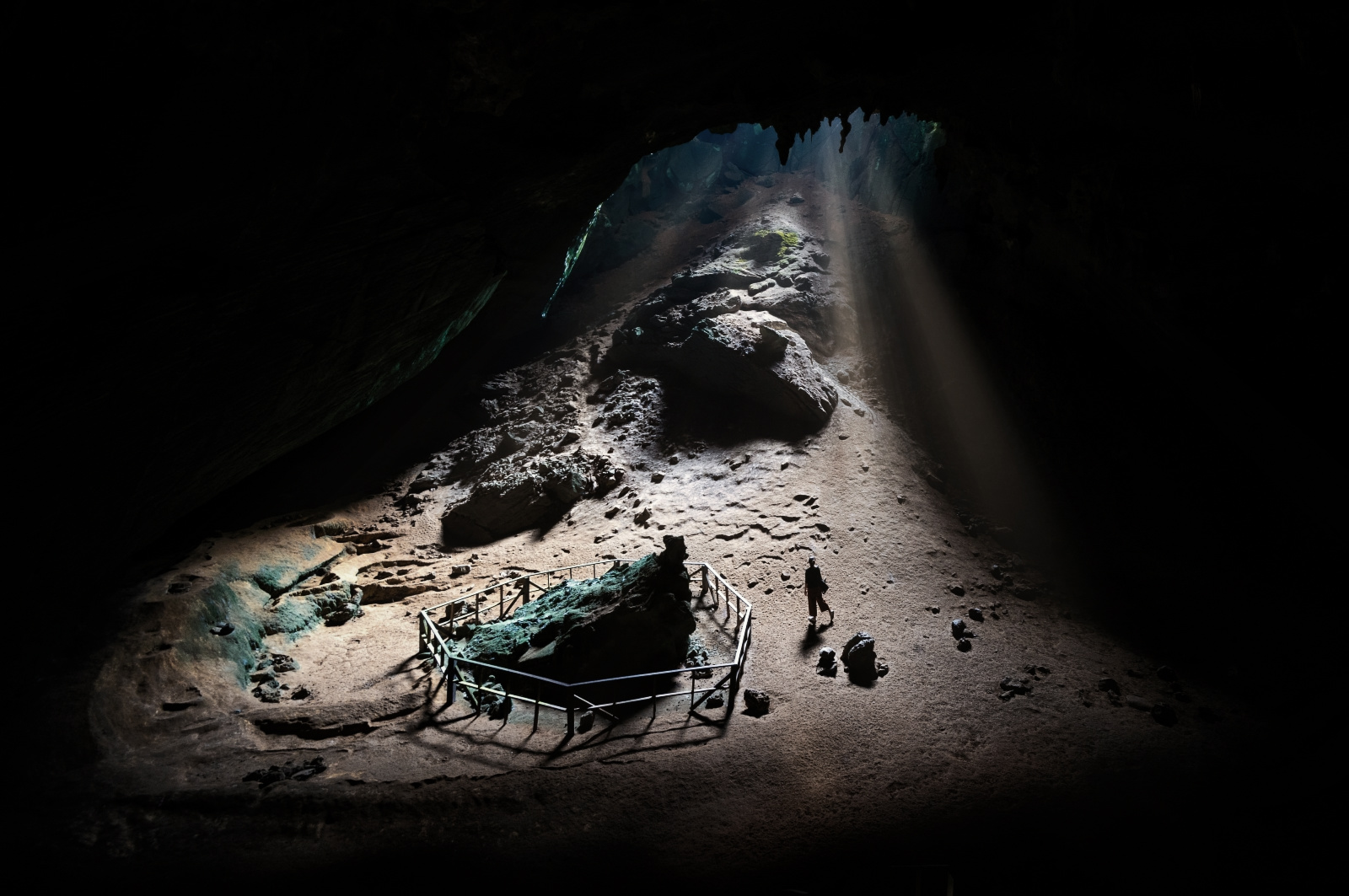 Phu Pha Phet Cave · ถ้ำภูผาเพชร
"Satun's karsts don't care about your travel itinerary. Stand here long enough, and you realize you aren't discovering the wild. It is simply allowing you to pass through."
Thirty seconds. One form. Zero tourist traps in your inbox.
No selling. No spam. We barely email — because we're too busy finding gems.
The Experience
Here's something your average beach brochure won't tell you: Satun Geopark isn't one landscape. It's five geological personalities spread across 2,738 square kilometres, two distinct zones, and approximately 500 million years of Earth being dramatically, extravagantly itself. The inland mountains tell one story. The coastal islands tell another. Together they tell the full story of how this corner of Southeast Asia went from ancient seabed to one of Thailand's most extraordinary — and least understood — natural treasures.
Quick translation before we dive in: when you see big numbers like "500 million years" or terms like Cambrian and Permian, think of them as chapter titles in Earth's diary. We'll explain what each chapter means as we go — no geology degree required, just curiosity and decent walking shoes.
Pack accordingly. You're going to need more than one day.
The Inland
World
Drive inland from Satun town toward Thung Wa and Manang districts and the landscape shifts personality immediately. The coastal breezes disappear. Limestone mountains rise from lowland forest without warning — sudden, vertical, ancient — like the earth got tired of being flat and simply stopped apologising. This is karst country — limestone landscape shaped by water slowly dissolving rock over millions of years, the same way a dripping tap eventually wears a groove into a stone sink, except here the "tap" has been dripping for longer than humans have existed. The result looks like nature hired a surrealist sculptor, handed them unlimited time and zero budget constraints, and said "surprise us."
These rocks formed during what geologists call the Paleozoic Era — think of it as "Earth's Ancient Sea Chapter," stretching from the Cambrian period through the Permian period (roughly 540 to 250 million years ago). This was all happening hundreds of millions of years before dinosaurs, when the only life around was swimming in warm shallow seas, experimenting with things like shells, legs, and eyes for the very first time.
Mainland Satun's crown jewel sits on the Thai-Malaysian border, and the first thing it does is make you question your entire relationship with the word "old." The limestone karsts rising from lowland rainforest here formed during the Triassic period — basically, the warm-up act before dinosaurs took the stage. These rocks predate the dinosaurs entirely. The dinosaurs themselves went extinct 66 million years ago and still feel historically remote to us — yet they were newcomers to geological formations Thale Ban has been casually maintaining since before their ancestors existed. Spend a moment with that. Take your time.
Thale Ban Lake reflects surrounding limestone peaks in water so still on windless mornings it creates that mirror-image photograph everyone assumes is edited. It isn't. It's just good timing and the absence of speedboats — which Thale Ban's remoteness handles naturally. The Ya Roi Waterfall trail winds through primary rainforest where the canopy closes overhead like a cathedral ceiling — perpetual green twilight until the trail opens onto limestone that was already ancient when the first humans were still debating whether fire was a good idea.
The limestone caves — Tham Ton Din, Tham Phra — are where the geology becomes intimate. Stalactites grow at roughly 1mm per decade, meaning the formation your flashlight just illuminated has been growing since before the Ayutthaya Kingdom existed. Local Muslims occasionally pray in these caves when travelling; the natural acoustics create reverb so extraordinary it sounds like the mountain is singing back.
Either beautiful or deeply unsettling, depending entirely on your relationship with acoustics. Something you will not forget either way.
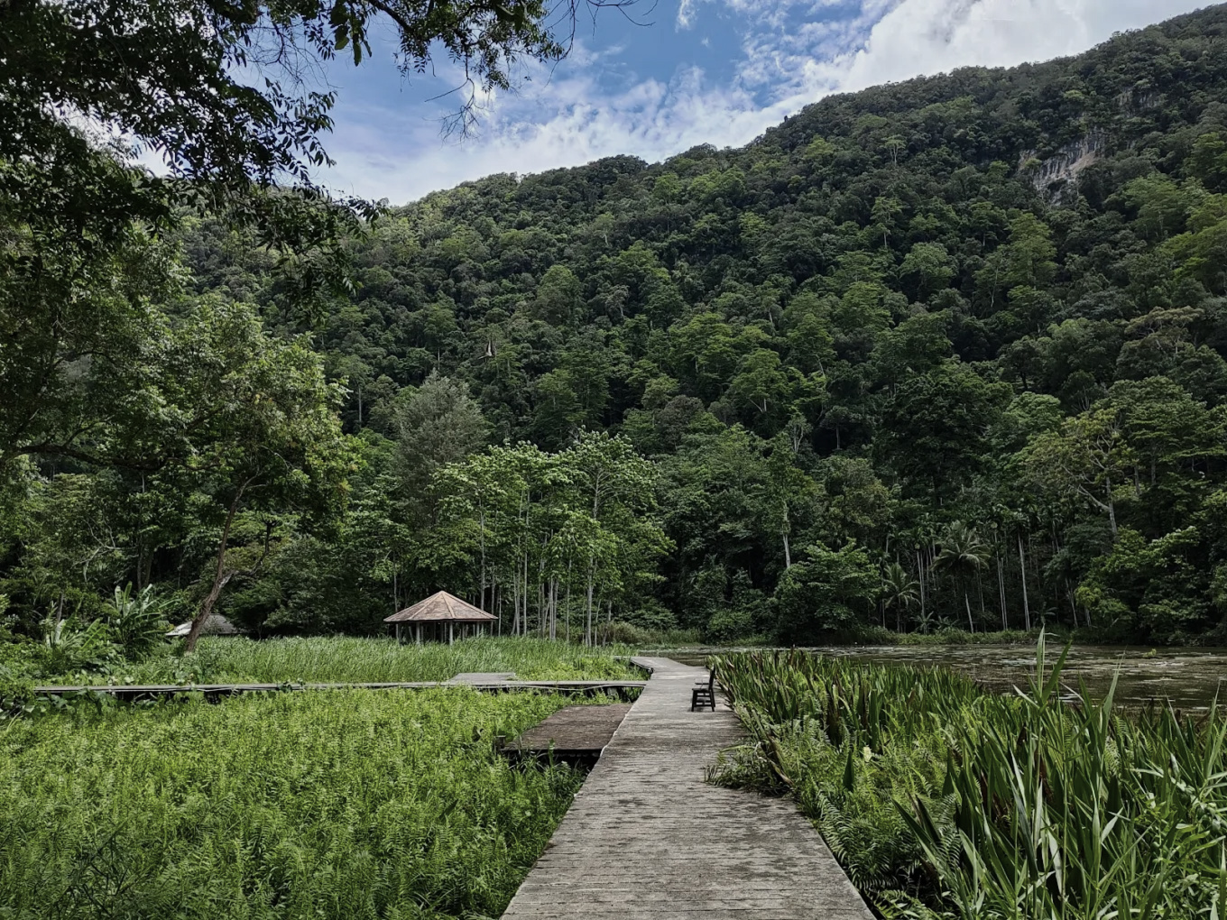
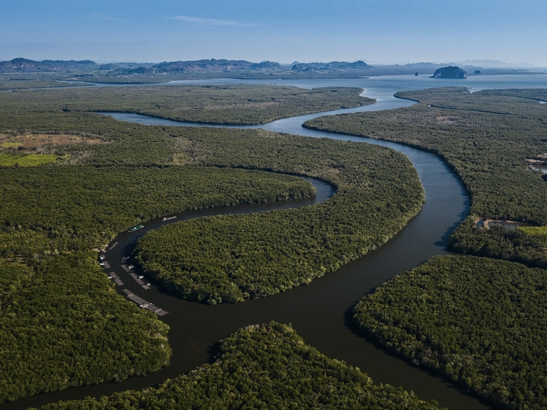
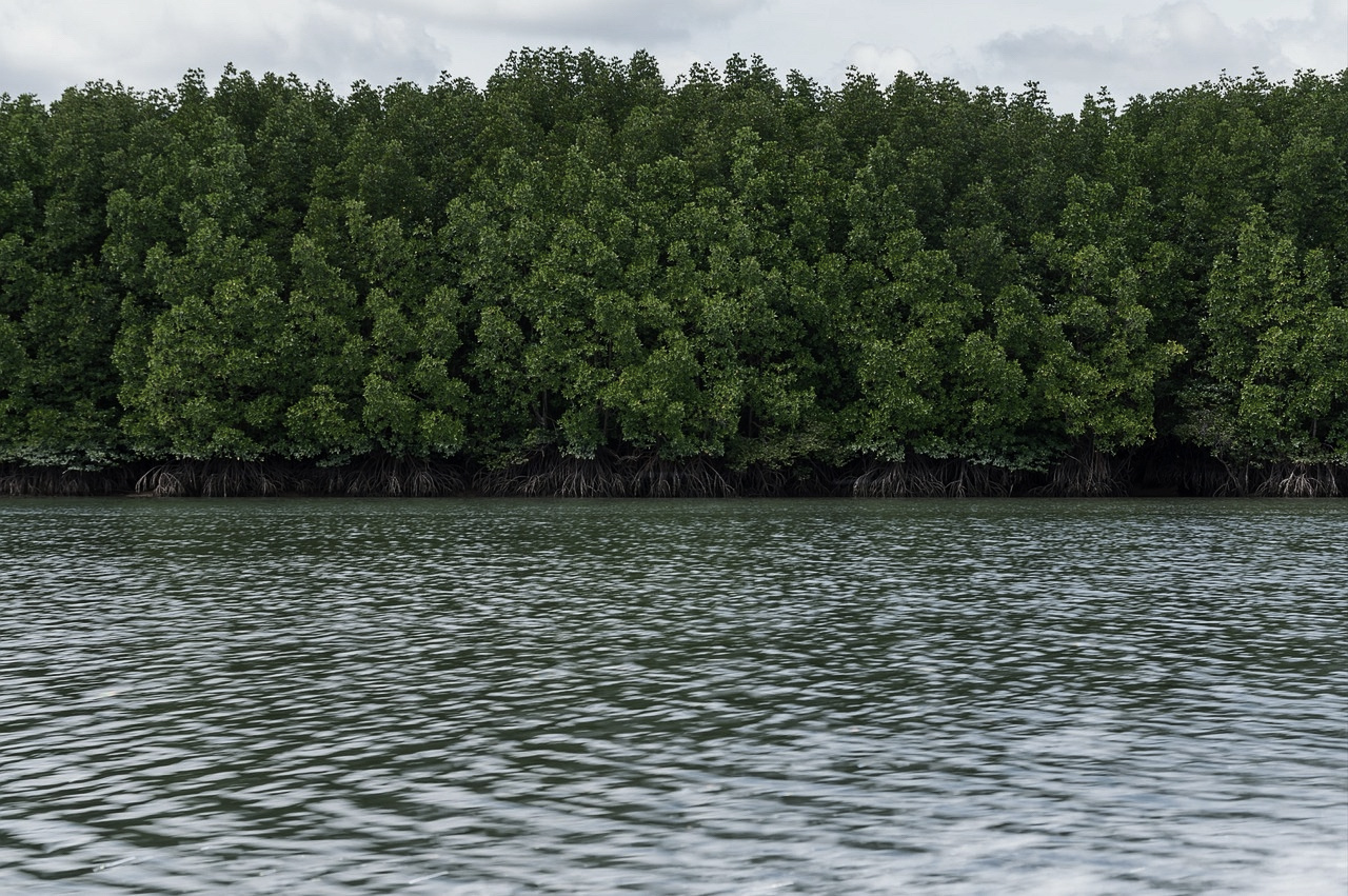
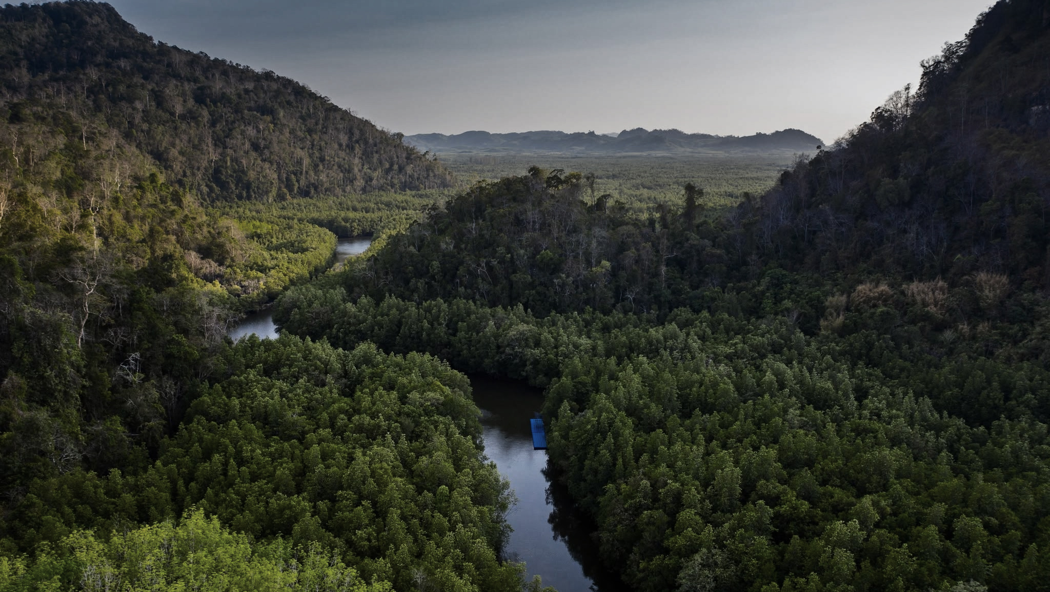
If Thale Ban is the ancient chapter, La-Ngu is the living one — and the boardwalk trail here is where the entire geopark concept suddenly makes beautiful, unified sense. Limestone karst creates specific coastal conditions. Those conditions grow mangroves. Mangroves protect coastlines, nurse fish populations, lock away carbon, and create habitat for creatures at various stages of evolutionary ambition. Mudskippers, for instance, who are either fish bravely experimenting with terrestrial life or evolutionary overachievers who got too ambitious — the jury remains pleasantly out.
A geopark guide once showed us how mangrove roots trap sediment, incrementally building new land at the water's edge. "The forest is growing," he said, gesturing at the shoreline with obvious pride. "Making more Thailand — slowly." We think about that sentence unreasonably often. The mangroves, apparently, are patriots. They're simply working on a longer timeline than most patriots bother with.
Stegodon
Sea Cave
Where a kayak paddle and a Pleistocene elephant share the same story — 3–4km of winding limestone tunnels, accessible by water, haunted by Ice Age megafauna that left before you arrived.
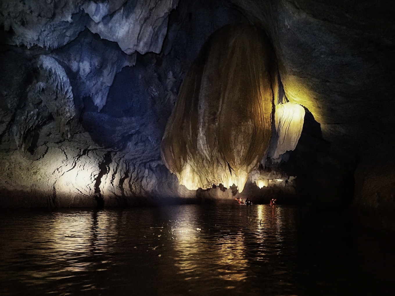
"There are caves you visit. Then there are caves that visit you back."
Stegodon Sea Cave · ถ้ำเล สเตโกดอนStegodon Sea Cave (Tham Le Stegodon · ถ้ำเล สเตโกดอน) in Thung Wa District is approximately 3–4 kilometres of winding limestone tunnels, partially influenced by seawater, accessible by kayak or on foot depending on season and water levels. The cave system is dramatic in the way that genuinely ancient underground spaces are dramatic — not manicured, not theme-parked, but raw limestone geology doing what it's been doing for hundreds of millions of years, completely indifferent to your schedule.
But here's the story that separates Stegodon from every other cave in southern Thailand. Inside these chambers, embedded in the limestone, scientists discovered the fossilised mandible — the jaw, with molars intact — of a Stegodon, basically an elephant's slightly weirder, slightly older cousin, that roamed Southeast Asia during the Pleistocene — think of this as "the Ice Age chapter," roughly 1.8 million to 10,000 years ago, recent enough in Earth-time that early humans were already around. Picture something between a mammoth and a modern elephant, navigating terrain that would eventually become this cave system, living and dying in a landscape utterly unlike what exists today. The jaw stayed. The Stegodon didn't.
Alongside it: remains of ancient rhinoceros, deer species, and other Ice Age-era animals that paint a picture of an ecosystem so different from present-day Satun it requires genuine imagination to reconstruct. When you kayak through Stegodon Sea Cave, torch beam catching the cave walls, water echoing in chambers shaped over millions of years, you're moving through the same space where this Ice Age elephant relative once existed. The jaw is no longer here — preserved properly for scientific study — but the limestone that held it for nearly two million years absolutely is.
Stegodon Sea Cave's Ice Age-era animal fossils help scientists understand how creatures moved across Southeast Asia when sea levels were lower and landmasses connected differently than today — essentially, ancient animal migration routes frozen in stone. This cave isn't just a pretty underground space. It's an Ice Age time capsule with excellent acoustics.
A word on fossils — and we mean this: Do not touch, remove, or disturb any fossil material anywhere in the geopark. Not a small piece. Not "just one." Satun's fossils are irreplaceable scientific records. They belong to geological time, not your pocket. Be the tourist who understands this. Not the other kind.
Khao To Ngai
Time Crossing
Most people cross time zones by changing their watch. Here, you cross geological time by taking a walk — a single coastal path that bridges 35–40 million years of Earth history in one afternoon.
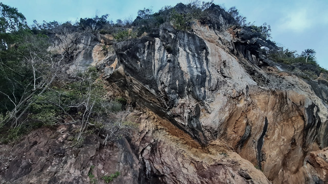
"Walk from one rock type to the other and you've just crossed approximately 35–40 million years of planetary history. No time machine required. Comfortable shoes recommended."
Khao To Ngai · เขาโต๊ะหงายKhao To Ngai (เขาโต๊ะหงาย) — sometimes called the Fault Plane or Time Crossing Zone — displays something that makes geologists genuinely emotional: a visible, physical stratigraphic boundary between two completely different rock types. Think of it like finding two different decades of newspaper stacked directly on top of each other — except instead of decades, you're looking at roughly 35–40 million years of Earth's history compressed into a single cliff face you can stand in front of and process with your own eyes.
On one side: red sandstone from the Cambrian period — "Earth's Ancient Sea Chapter, Volume One" — deposited roughly 500 million years ago when this region was seafloor hosting some of the planet's earliest complex life. On the other: limestone from the Ordovician period — the next chapter — formed approximately 460–485 million years ago from the accumulated remains of marine creatures living in shallow tropical seas. The boundary between them is a literal chapter break in Earth's autobiography.
What makes Khao To Ngai internationally significant isn't just the boundary itself — it's its clarity and accessibility. Boundaries this old exist in various places globally, but finding one this clearly exposed, this visually dramatic, this walkable by complete beginners is genuinely rare. UNESCO didn't designate this geopark for scenic reasons alone. Sites like Khao To Ngai are why the designation exists.
You will stand in front of this rock face and your brain will do one of two things. Either it will short-circuit trying to comprehend 500 million years compressed into a coastal cliff (correct response) — or it will say "those are just rocks" and want to move on to snorkelling (also fine). We gently suggest spending five minutes letting the first response win.
The boundary at Khao To Ngai helps scientists worldwide piece together what ancient oceans looked like and how early sea life evolved and spread across the globe. This little stretch of Satun coastline is genuinely part of the global record books — not just a regional curiosity. It's a page in Earth's story that happens to be sitting in southern Thailand, walkable on a Tuesday afternoon.
Conservation rule: No rock sampling. These are globally significant stratigraphic records. Photograph enthusiastically. Touch the rock if you must. Take absolutely nothing.
The Coastal
& Island World
Leave the inland mountains behind and drive south toward La-ngu and Mueang Satun districts. The landscape opens, the Andaman Sea appears between limestone peaks, and suddenly the same geological story that played out underground in Zone 1 is happening above water, in full colour, surrounded by turquoise sea and the kind of island scenery that makes photographers question whether they've accidentally walked into a screensaver.
Don't be deceived by the beauty. Satun's coastal limestone karsts aren't merely decorative — they're the same ancient seabed rock from Chapter 1's "Ancient Sea Chapter," except here, the forces of the planet pushed them above sea level and the ocean took over the sculpting job from groundwater. Same 500-million-year story. Different artist. The islands aren't random. They're the peaks of ancient limestone formations that refused to be fully submerged — geological survivors wearing their age in every eroded surface and fossil-studded cliff face.
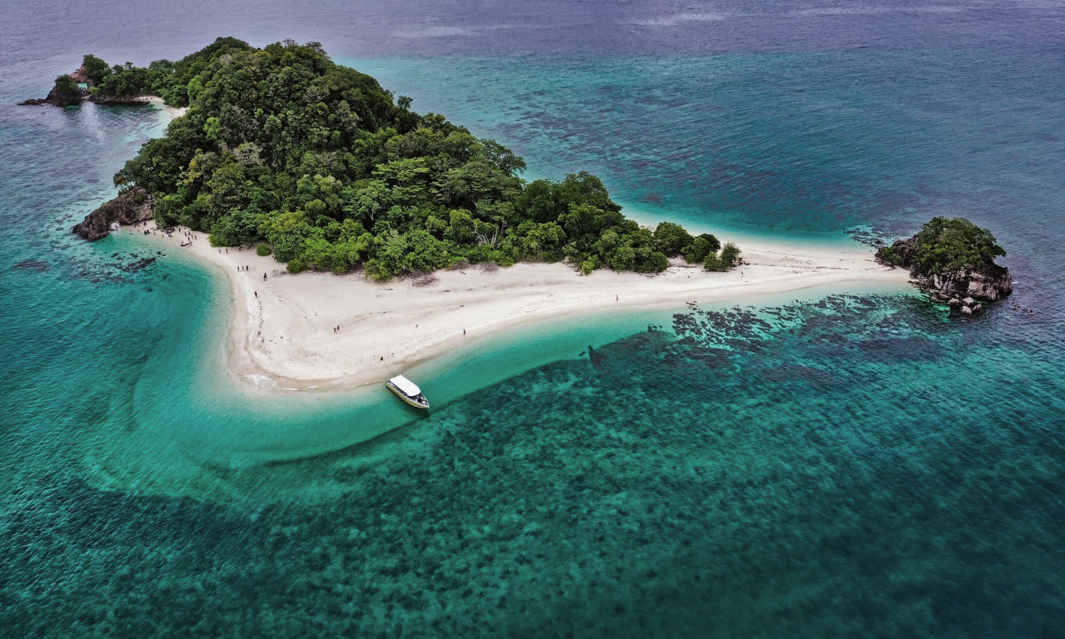
Ko Tarutao Marine National Park is where Satun's geological drama becomes fully cinematic. Limestone karst islands rise vertically from water so clear you can see reef systems from the boat before entering the water — sea caves carved by millennia of wave action into passages large enough for kayaks, hidden lagoons where limestone walls tower overhead while hornbills nest in cliff holes, beaches backed by rock faces showing layered stripes of rock like a cross-section in a textbook. Except real. And touchable. And roughly 300 million years old.
The snorkelling operates at a different altitude of experience here. Underwater limestone formations create habitat so rich that even the background fish — the ones that aren't the headline species — are extraordinary. Swim far enough along Tarutao's western coast and whale sharks occasionally materialise from the blue distance with the casual energy of something that has been swimming these waters since long before human beings existed as a species.
Here's the part that surprises most visitors: most day-trippers from nearby Ko Lipe see beach, snorkel, beach bar, photo, longtail boat back. Pleasant trip. But that's roughly 30% of what's actually within kayak distance. Ko Adang, Ko Rawi, Ko Yang — three islands sitting in the geopark's most pristine zones — see so few visitors that fish behaviour is genuinely different. Unhurried. Curious. Present in a way that reef fish in high-traffic areas simply aren't. They look at you. This is unsettling and wonderful in equal measure.
What looks like "another island" in a brochure looks like a 300-million-year outdoor classroom when you know what you're reading.
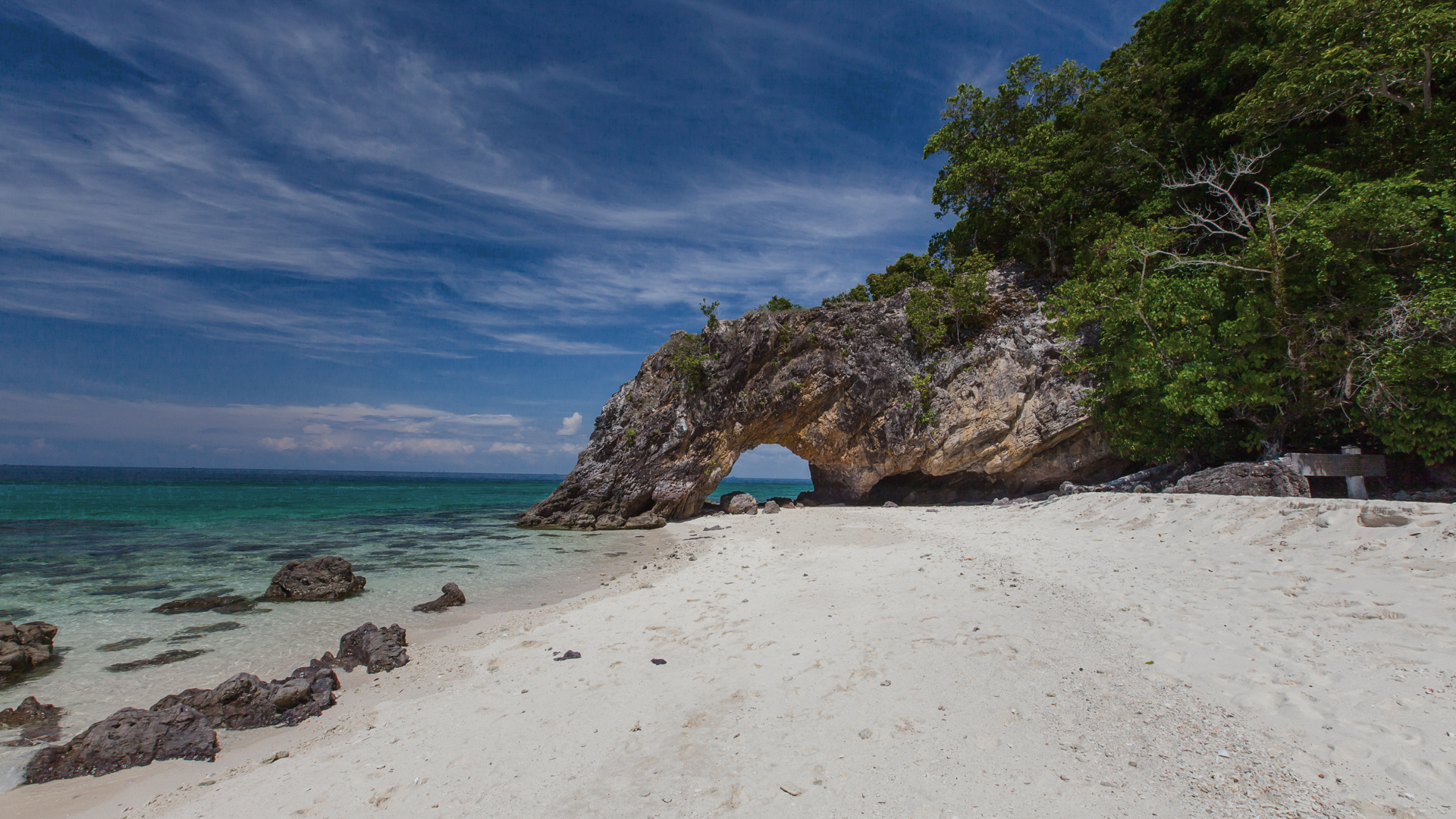
Ko Khai (เกาะไข่ · Egg Island) in Tarutao National Park is home to one of Satun's most photographed geological features: a natural limestone arch carved entirely by wave action over thousands of years, framing a perfect rectangle of turquoise Andaman Sea. The arch is large enough to kayak through, dramatic enough to stop conversations mid-sentence, and old enough that local legend attached romantic significance to it — walking or paddling through is said to bring eternal love. Geology as matchmaker, which is a career pivot nobody saw coming.
Here's the part that surprises most visitors: the arch is still being built. The version you'll see today is not the one that existed a century ago, and it won't be the same one your grandkids would see a century from now. Geology doesn't really do "finished" — it does "ongoing."
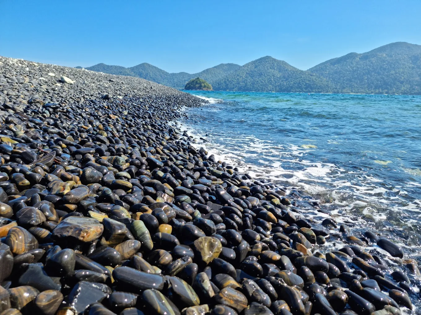
Ko Hin Ngam (เกาะหินงาม · Beautiful Rock Island), 15 minutes by boat, features something genuinely unlike anywhere else in Thailand: a beach covered entirely in smooth, shiny black pebbles with striking natural patterns — stripes, swirls, and markings that look less like geological accident and more like someone spent considerable time decorating stones individually.
They didn't. Millions of years of coastal tumbling did — the way a rock tumbler polishes stones, except the "machine" here is the entire Andaman Sea and the cycle time is measured in millennia. Every pebble is a tiny cross-section of ancient seafloor. Local legend adds its own conservation mechanism: removing pebbles brings terrible misfortune. Whoever invented this legend was an extremely effective conservationist who understood human psychology long before UNESCO existed.
Prasat Hin
Panyod
Stone Castle of a Thousand Peaks. Save this for last. Not because it's the furthest — though it is. Because it is, without qualification, the experience that makes every other site in Satun Geopark feel like the opening act.
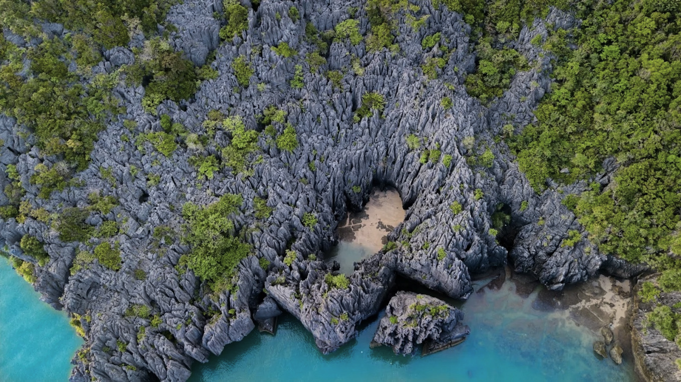
"The earth spent half a billion years building this — layer by layer, fracture by fracture, tide by tide — and then hid it inside a ring of limestone so sharp it keeps the careless out. Satun doesn't advertise its treasures. It simply keeps them, beautifully, for the people who look carefully enough."
Prasat Hin Panyod · ปราสาทหินพันยอดLocated near Ko Khao Yai (เกาะเขาใหญ่) in La-ngu District, accessible from Pak Bara Pier, Prasat Hin Panyod is described by geopark scientists as the most important single geosite in all of Satun UNESCO Global Geopark. Once you see it, that designation requires no further explanation.
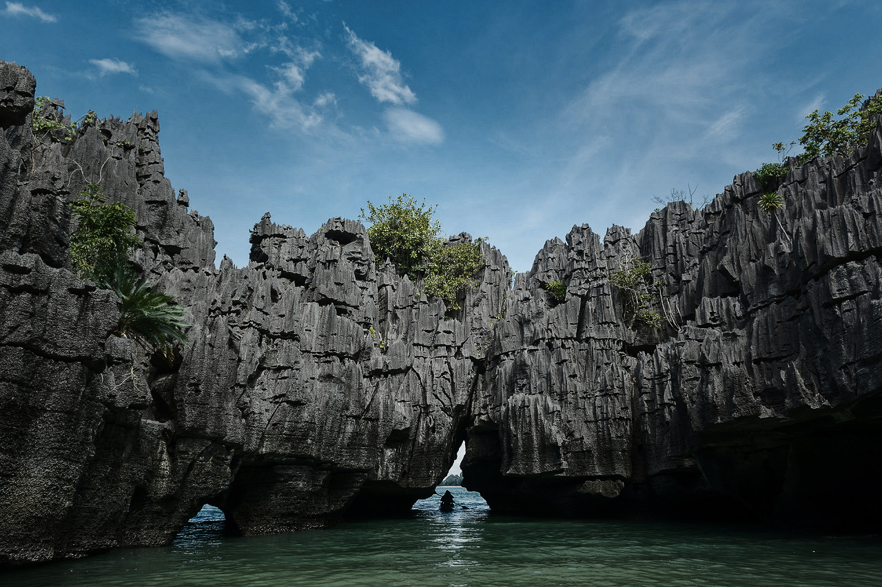
The site features spectacular pinnacle karst — limestone towers rising from the sea in formations so vertical, so dramatically sculpted, so improbably sustained that your first instinct is to look for the architect's signature. There isn't one. Just 500 million years of ancient seafloor limestone getting pushed upward, cracked, rained on from above, eroded by waves from below, and sculpted into something that looks like nature was commissioned to build a castle and responded with characteristic excess.
The kayak approach changes everything. Tours bring you by boat to the site, where you transfer to kayaks for the approach through a sea cave — navigable only at certain tide levels, which creates a natural access filter ensuring visitor numbers stay manageable and the experience stays extraordinary. You paddle through limestone darkness, cave walls close enough to touch (please don't — these formations grow at roughly the speed of a fingernail over an entire century, and your handprint costs more time than it's worth), water echoing in chambers shaped by process that makes human history look like a footnote.
Then the cave opens.
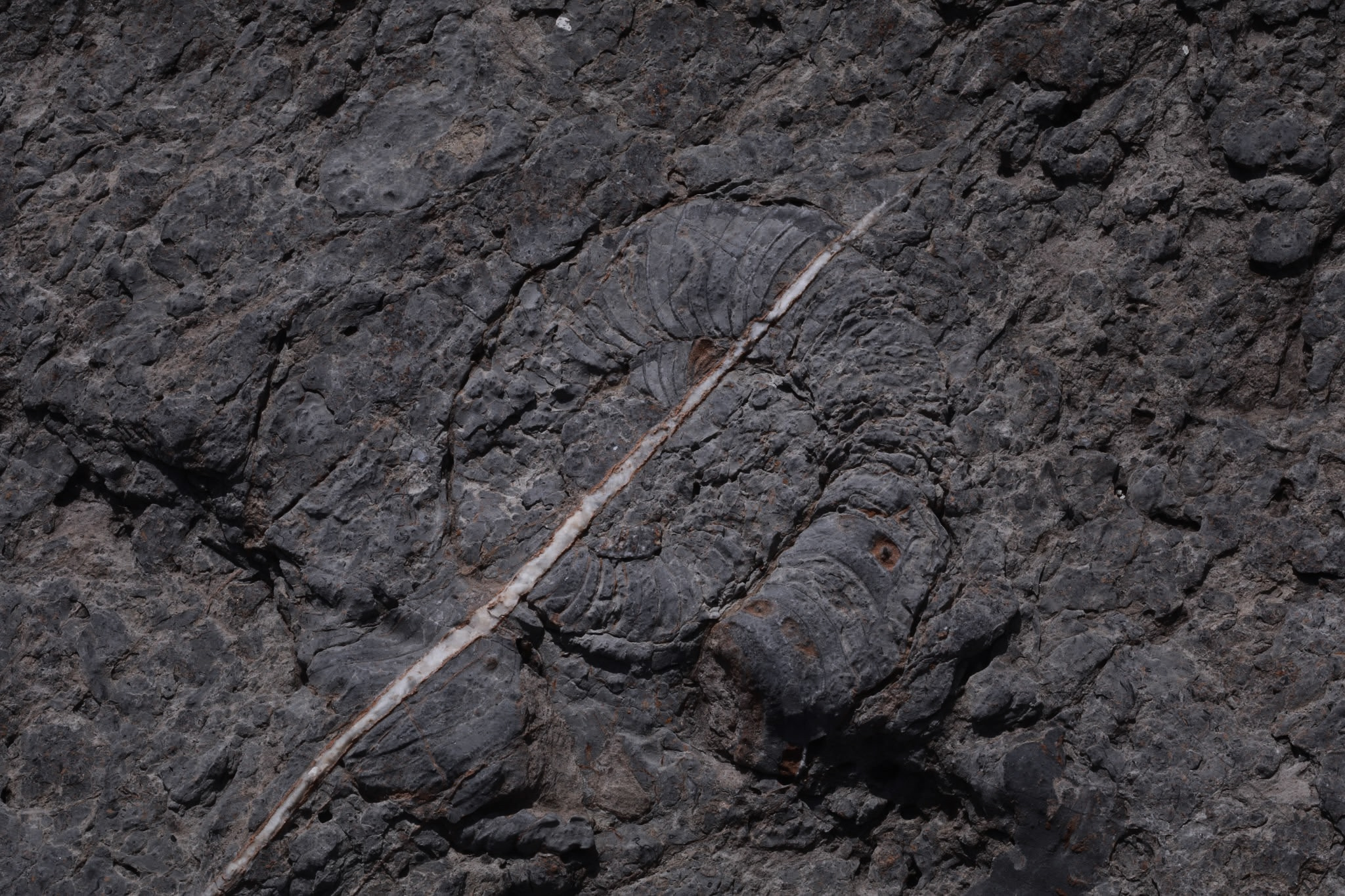
You emerge into a hidden lagoon — a secret inland sea surrounded entirely by limestone pinnacles, open to sky above, enclosed by ancient karst on all sides. The water is calm, clear, sheltered from Andaman swell by the same rock formations that took 500 million years to get here. Embedded in the cave walls: fossilised nautiloids — basically squid's great-great-great-grandparent, except it lived inside a coiled shell that looked a bit like a ram's horn crossed with a snail. These ancient sea creatures swam in the same waters that eventually became this very rock, hundreds of millions of years before anything resembling a human walked anywhere on Earth.
This is the moment. This is why Satun Geopark earned UNESCO designation. This is what 500 million years of patient geological work produces when left largely undisturbed.
Prasat Hin Panyod packs the entire Satun story into one site — ancient seafloor pushed up into towers, sea caves carved by waves, a lagoon formed by dissolving rock, and fossilised sea creatures still tucked into the walls from when this was all underwater. It's most important because it tells the whole 500-million-year story in a single visit. In one afternoon. By kayak.
On the nautiloid fossils: They're visible in the cave walls. They're astonishing. They're hundreds of millions of years old and they are staying exactly where they are. Observe them. Photograph them. Tell everyone you know about them. Do not touch, trace, or disturb them in any way. The privilege of seeing them depends on every visitor treating them as the irreplaceable scientific heritage they are.
From an Ice Age elephant's jaw in a Thung Wa cave to ancient squid-relatives fossilised in Prasat Hin Panyod's hidden lagoon. From walking between two geological eras at Khao To Ngai to paddling beneath a slowly-growing limestone arch at Ko Khai. From Ice Age megafauna to creatures that swam Earth's earliest oceans. From ancient mountain karst to Andaman island seascape.
Satun Geopark isn't one experience. It's Earth's autobiography split into chapters, spread across two zones, 27 geosites, and 500 million years — with a few excellent southern Thai restaurants in between chapters, because even geological pilgrimages require proper meals.
Most visitors who come to southern Thailand never make it here. They're busy elsewhere, doing lovely things at lovely beaches, not knowing that 500 million years of extraordinary planetary history sits two hours from Phuket, largely unvisited, waiting with the patient indifference of ancient limestone for the travellers curious enough to show up.
You showed up. Now go slowly. Ask questions. Don't touch the fossils. And bring enough memory card space for the hidden lagoon — you're going to need it.
"The limestone didn't just shape the coastline. It shaped the water chemistry, which shaped the fish populations, which shaped the fishing methods, which shaped the communities, which shaped everything about what this place is today. Pull one thread, and 500 million years of geology moves with it."
These oysters grow on limestone substrate in brackish channels where freshwater and Andaman Sea water mix in proportions created by the specific karst geography of this coast. The calcium-rich limestone water produces shells with mineral density and meat with sweetness that oyster specialists — who are, yes, a real category of person, and they're very serious about it — make pilgrimages specifically for. The geological explanation of why they taste different here is, unusually, also a complete explanation of why they're delicious.
Rice noodles topped with fish curry made from mackerel caught in mangrove-sheltered waters, curry paste built from herbs grown in limestone-soil conditions, coconut milk from palms drinking this specific coastal water for decades. This dish doesn't just taste like southern Thailand — it tastes like this specific piece of southern Thailand, shaped by the geology underneath it in ways that would require an entire geopark to properly explain. The morning market in Satun town opens at 5am, closes around 8am because the locals have been there since 5:30 and have already eaten twice.
"Most tourists see pretty islands. Geopark visitors see 500 million years of Earth's autobiography written in limestone — with mangroves adding footnotes, fish adding punctuation, and fishing communities providing the translation that makes the whole story make sense."
Deep Time Reality Check
Satun Geopark protects extraordinary geological, ecological, and cultural heritage. It also operates on its own timeline — which is, depending on which layer of the park you're visiting, somewhere between a few centuries and half a billion years. Calibrate accordingly.
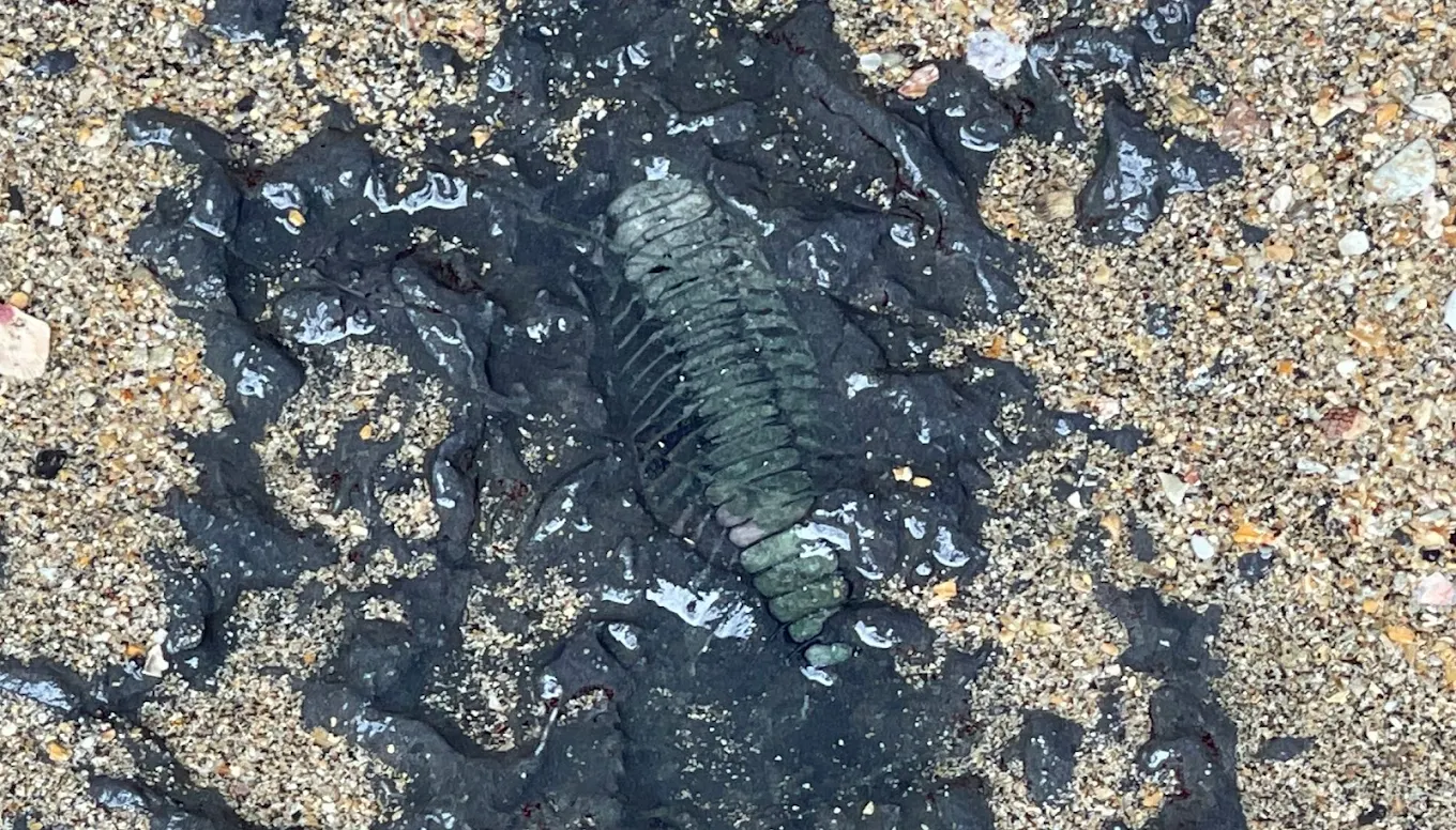
- Fossil (No digging required) — A half-billion-year-old trilobite fossil at Prasat Hin Pan Yod serves up deep history right at eye level. Spot it, admire it, leave it.
- Living limestone ecosystems — mangroves, seagrass, coral reefs, and cave systems, all visibly interconnected
- Chao nam fishing communities — reading water that geology shaped, in practice daily
- Extraordinary birds — hornbills, kingfishers, rare pittas at Thale Ban, over 200 recorded species
- Mudskippers in the mangroves — fish attempting land, baffling everyone including themselves
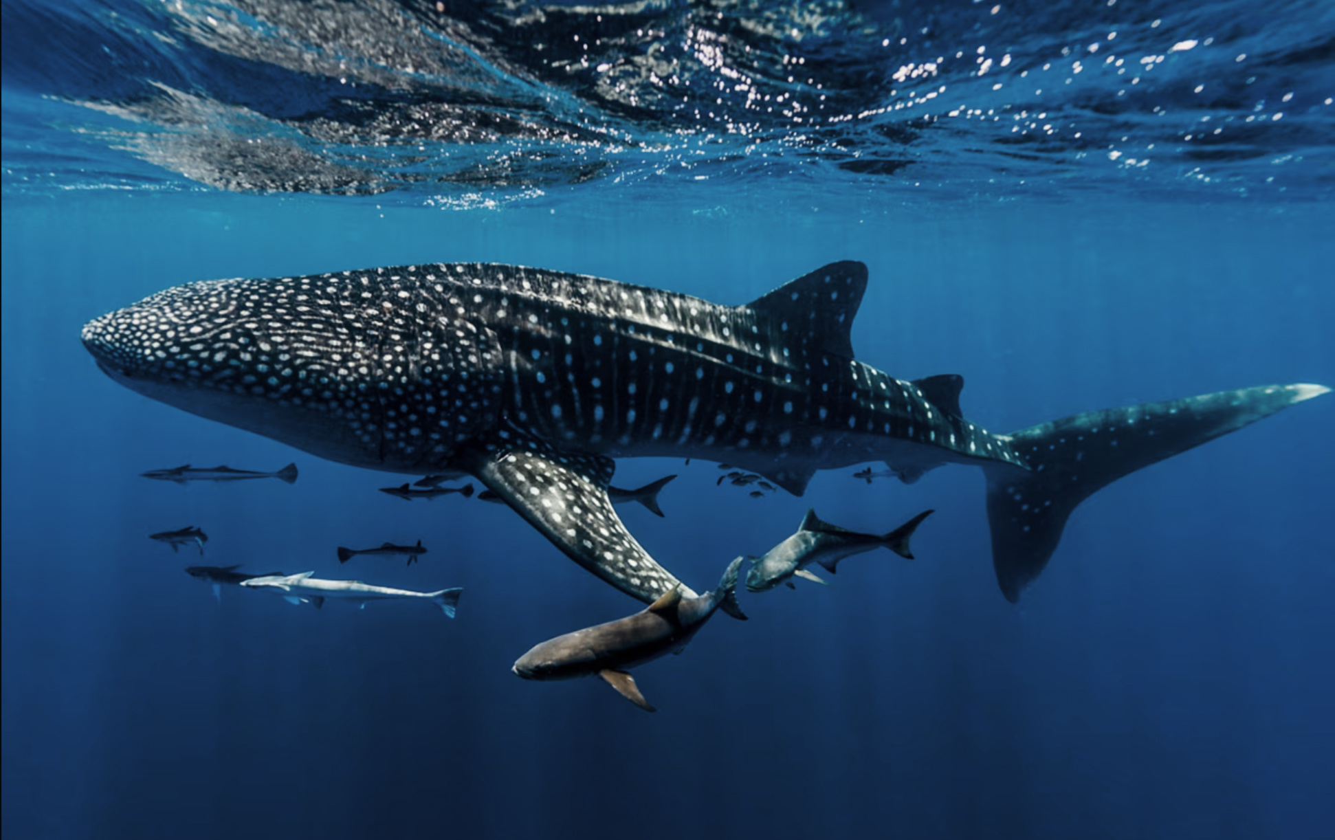
- Whale sharks at Ko Tarutao's western coast — 28 million years old, operating on their own schedule, no contractual obligations
- Urak Lawoi cultural practices — accessible through relationship, not reservation, and worth every day it takes to earn
- Thale Ban Lake's perfect mirror — windless pre-dawn, requires timing you cannot engineer, only arrive for
- Bioluminescence in mangrove channels at night — the sea glowing where disturbed
- Cave fish in underground streams — Thale Ban's deeper cave systems, guide essential
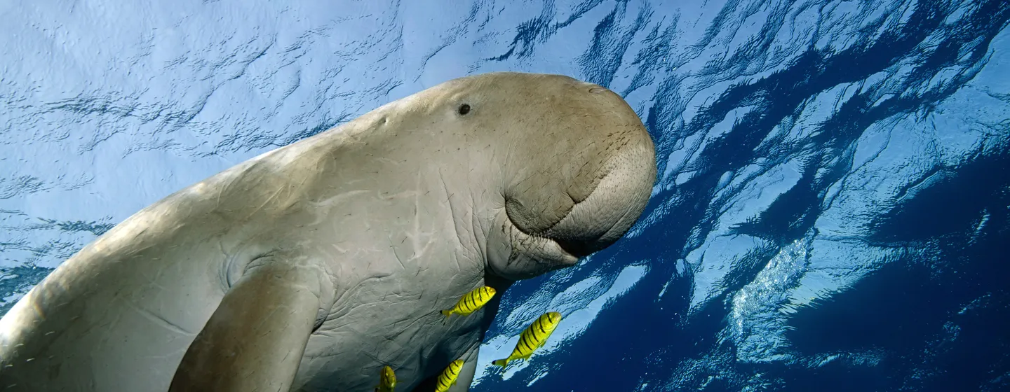
- Dugongs in Ko Adang and Ko Rawi seagrass beds — confirmed present, operating on geological patience
- The full geological narrative felt as one continuous experience — Cambrian to present, clicking together as a single understood story. Requires time. Cannot be rushed.
- Specific acoustic phenomena in Thale Ban caves — the mountain singing back. Worth an entire visit.
- Urak Lawoi night navigation — reading stars mapped to limestone formations their ancestors named. The rarest, richest sighting of all.
This is a geopark, not a theme park. The 500-million-year timeline operates on its own terms. Yours is the shorter one — spend it accordingly.
 Thaitop.co
Still Here.
Still Working.
Still Magnificent.
The rocks shaped the water. The water shaped the fish. The fish shaped the people. The people, when paying attention, shaped the preservation of everything beneath it.
The Aha Moment
When you're kayaking through La-Ngu's mangrove channels at dawn — paddle barely disturbing the surface, limestone cliffs rising on both sides with 470-million-year-old fossils sitting at eye level, the only sounds a kingfisher's dive and your guide's quiet narration about how this channel's curvature maps directly to a limestone formation created 300 million years ago — there's a specific kind of understanding that arrives without being summoned.
This place isn't protected because someone decided it was important. It's intact because the people who've lived here for generations understood, in practice and in daily life, what we're only beginning to articulate in policy language: the rocks shape the water, the water shapes the ecosystem, the ecosystem shapes the human culture, and the human culture — when it's paying attention — shapes the preservation of everything beneath it.
The Urak Lawoi didn't need a UNESCO designation to understand these islands were sacred. The chao nam fishermen didn't need a marine biologist to tell them that destroying the mangroves would destroy the fishery. They knew — because 500 million years of connected systems had been their classroom, and they'd been attending it every day.
You've just walked into a place where geology, ecology, and human wisdom have been in conversation for longer than civilization has existed. UNESCO had to fly in and point at it before we fully grasped what we had. That's a little embarrassing. It's also, given what's here, completely understandable. Some things are so comprehensively extraordinary that they require a formal introduction.
Practical Intel
From Bangkok: Fly to Hat Yai (1hr) → 1.5hr drive to Satun town. OR fly to Trang (fewer flights) → 1hr drive.
Hat Yai → Satun: Minivan ฿150–200 · Private transfer ฿1,200–1,800
Satun town → Pak Bara pier: 60km, ~1hr (island ferry hub)
From Malaysia: Ferry from Langkawi to Pak Bara (seasonal) — Satun is genuinely closer to Langkawi than to Bangkok. This is both geography and a strong hint.
Dry Season (Nov–Apr): Best weather, calm seas, all sites fully accessible — book accommodation ahead for peak months.
Wet Season (May–Oct): Islands and offshore sites close; rough seas. BUT mainland Thale Ban National Park and La-Ngu mangroves remain open with dramatically atmospheric conditions and zero crowds. The mangroves in monsoon mist are genuinely extraordinary and entirely under-visited.
Ramadan: Check dates annually — restaurant hours shift, plan accordingly. The cultural experience during Ramadan is itself worth the logistical adjustment.
Geopark HQ: Satun town · Mon–Fri 8:30am–4:30pm · Free entry · English-speaking staff · Free maps · Guide booking
☎ +66 63 465 4924 · Book guides 1–2 days ahead
Key entry fees: Thale Ban NP ฿200 · La-Ngu Geotrail free (donations appreciated) · Ko Tarutao Marine Park ฿200 · Ko Lipe included in Tarutao entry
Start at Geopark HQ. The free orientation map transforms navigation from guessing to purposeful — the difference between a scenic drive and an understood landscape.
Start at Geopark HQ in Satun town. This is not optional. The free orientation map and staff briefing transform the geopark from a collection of pretty places into a coherent 500-million-year narrative you can actually navigate. Thirty minutes here saves you from two days of missing the point.
Ask your guide about their family's relationship with this landscape. The personal stories make the geology human. The guide who explains the same cliff face their grandfather fished beside for sixty years, reading the same currents that the same limestone still creates — that's the Satun Geopark experience at its fullest.
Dawn mangrove kayaking at La-Ngu is the best photography window. Mist + golden light + prehistoric rock formations + absolutely nobody else there = entirely unreasonable beauty. Book the night before at your Pak Bara accommodation. Bring the widest lens you have. Accept that no photograph will be adequate, and plan to come back anyway.
Explore the Geopark
Ready For Your Next Move?
Share your fossil-touching moment. The thing your guide told you that rewired your brain permanently. The exact second you realized "pretty islands" was the understatement of 500 million years. Or simply your best mudskipper photograph, because we too find them compelling and slightly alarming.